Lessons learned from my AZT hike
Personal challenges: The biggest mental challenge is solitude. I'm not sure how you prepare for that, just acknowledge it. Your smart phone is a big help here, load it with books and music to keep your mind occupied both while hiking (I did this occasionally) and in the evenings (I used it almost every night). If you're in good general cardio and endurance sports condition, I think the physical demands of the hike are more easily met than the mental ones.
When to do the trip (and reasons): While I've not done the trip in the spring, conceptually it seems like a better time than the fall and here's why.
- Availability of water: Water supplies should be more reliable in the spring, if the winter rains and snows have been good. My experience in the fall was that, despite a good monsoon, the dry spell before the winter rains can wither many of the springs and creeks down to nothing in short order.
- Length of days and nights: Another big reason to do the trip in the spring instead of in the fall is that days are getting longer in the course of the former vs shorter during the latter. And too much darkness can add to the mental challenges as well as limit the daily distance you can cover.
- People on the trail: My chats with thru-hikers and reading their blogs indicates that there are many more people doing the trail during the spring, which would increase the frequency of social interactions, alleviating the main mental challenge alluded to above.
Nutrition: I based my diet on 3000 cal a day, 50% over the "normal" 2000 cal per day diet (there are any number of calorie requirement calculators based on activity on the web that I used, but generally came up with 3000-4000/day). 3000 cal/day was manifestly too few for me, evidenced by the fact that I lost nearly 20 lbs on the trip. Next time I'll err on the high side here and go with 3500 or 4000 cal. The issue with the latter is actually coming up with things you can eat to get you to that level that have very high caloric density (so the added weight isn't overwhelming) and are consistently palatable, so that you don't get sick of them. Good luck! One thing I did try, with partial success, was using meal replacement powders that you mix with water for a good percentage of my calories. Soylent (Soy based, obviously) was by far the best, Garden of Life (plant based) second and Optum (milk based) the worst. Not only do these powders get you get a good slug of calories (400/serving, in the case of Soylent), but they also give you doses of vitamins and minerals, which may be missing from some of your other foods.
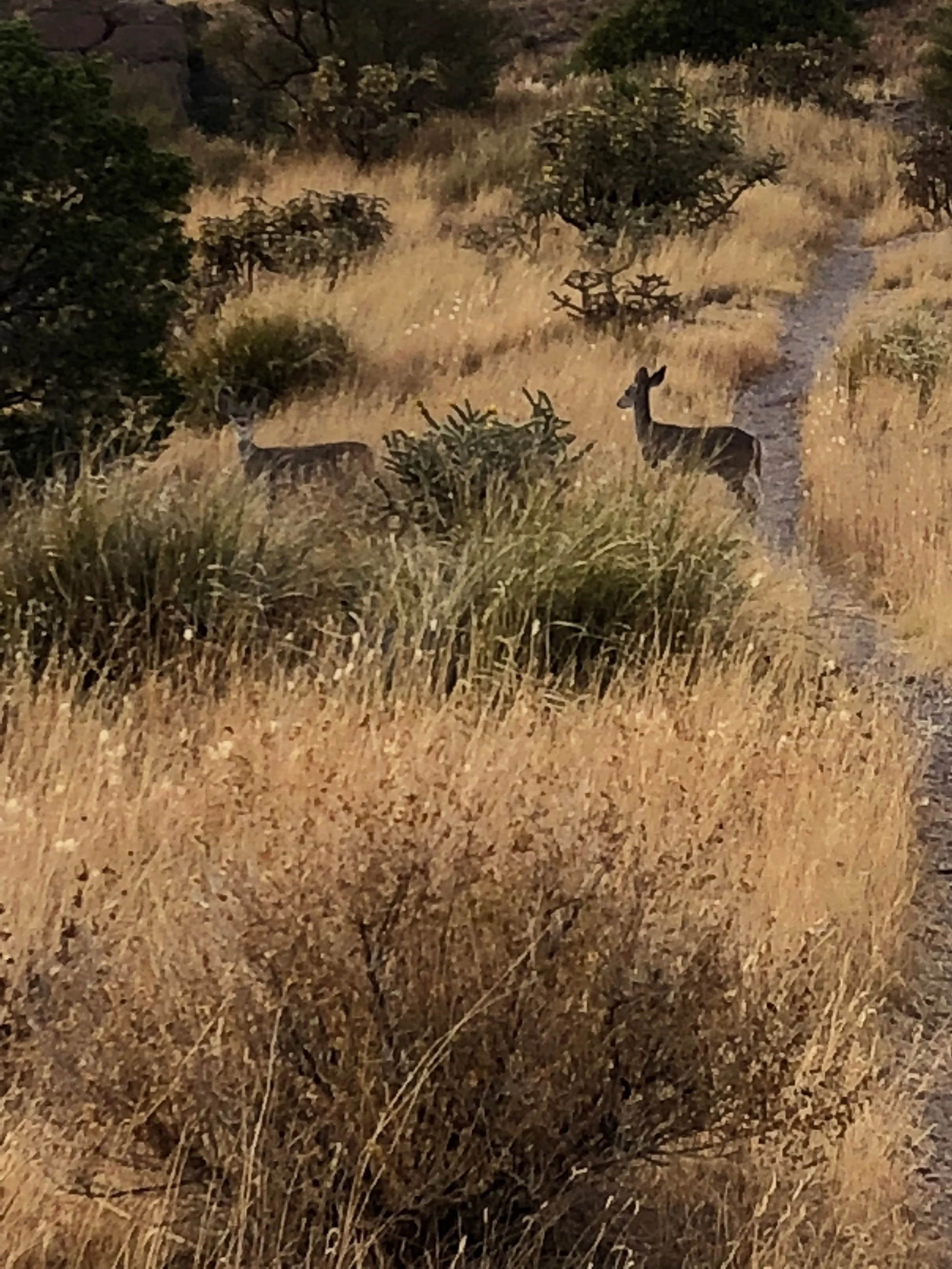
Safety: Based on my years of experience as an exploration geologist working in remote locations worldwide, I consider the most important safety attributes a person can have are preparation, attitude and common sense. Care and attention to detail in planning and execution of your activity includes inventing and running through scenarios that might occur, assessing their likelihood and having a plan. Here are the scenarios I came up with, modified based on my actual experience on the trail, in descending order of likelihood, with comments on severity and risk-mitigation:
- Running out of water. I found my consumption ranged from about a gallon per day on cool days in easy terrain, to 2 gallons per day when it was hot and I was doing a lot of climbing. Remember you can survive for 3 weeks without food, but only 3 days without water. In most cases the AZT is no more than a day's hike from a well travelled road, so getting water or a ride to water is doable if all other sources fail you. I also found that in the fall, bowhunters are about the only other people I ran into on or near the AZT and they are very kind about helping out by giving you any extra water they've got. While I put out water caches along a couple stretches of the trail (Tusayan to Babbitt Ranch, Mormon Lake to Blue Ridge Reservoir and Kelvin-Riverside to Oracle), there were stretches without 4wd road access where I didn't and ran perilously low.
- Trip, slip or fall resulting in anything from a twisted ankle to a broken bone. Carry along 1" adhesive tape (practice taping your own ankle a few times at home before you set out) and/or an Ace bandage for twists and sprains. Breaks will require evacuation.
- Getting caught out in a rain/sleet/hail storm resulting in hypothermia or danger from lightning strikes. You've got about 30 min to get your body temperature under control in cases of hypothermia (or hyperthermia, for that matter), so having the right gear and a plan are essential here. In the case of getting struck by lightning, you're probably toast...figuratively and literally! The best plan here is to lower risk by getting under lowish trees on the edge of high hills or timber, put your warmest clothes on under your rain gear and wait out the storm. I ran into this situation in September, up on the Kaibab, north of the Grand Canyon.
- Small critter bites and stings, ranging from ants, bees, scorpions, to snakes and rabid mammals. For the insect bites, you should have along, at a minimum, a supply of Benadryl and, if you're allergic, an Epipen. Snake and rabid mammal bites are much more serious and require getting professional medical treatment ASAP.
- Bear attack. Very low probability but severe consequences. Probability increasing around high-country towns and much-used campsites. Be sure you've got a "bear bag" and use it! I carried all of my food in a small, lightweight daypack inside my larger pack, with each day's food in a sealed ziplock-type plastic bag inside it. I used about 30' of lightweight nylon cord with a carabiner on one end to hang the bear bag up at least 50 yds from my tent after I'd finished my evening meal. I also try to keep a very clean camp in general to remove temptation.
- Wildfire. Very low probability but severe consequences. Best to be aware of any that are burning near the trail and re-route to avoid those areas.
Once in the field, the ability to stay calm and positive, then act based on your training and instincts is most important.
Two of the things that will help the most getting you out of any of the severe situations noted above are accurate knowledge of your location and the ability to communicate both your location and status to your support team and/or emergency services. If you get into trouble, but you know where you are (preferably in terms of lat-long coordinates) and have the means to communicate that information to emergency services (tel #s of which you should have written on a card with you) along with a concise description of what the problem is, there's a high probability you can get timely help. Do not rely on your cell phone for the communications function on the AZT, as I found that, in the case of Verizon, useful (i.e. the person on the other end could actually hear me) coverage was 50% or less of what they show on the map on their website. On the other hand, for location, the Guthook AZT app, which can be downloaded onto your smartphone through the AZT website, is very good for locating and tracking yourself along the trail and I used it constantly. It also has water source information that is constantly updated by users, a super-useful feature here.
While the Guthook app was great for keeping me located, it did nothing for letting others know where I was. That task fell to my Garmin InReach EXPLORER+ device. This was my primary emergency location and communications tool. It is a very useful combination of a high quality GPS with an Iridium satellite-based communications unit. Three very important functions performed by the InReach, all independent of cell coverage, are 1) it automatically sends out your coordinates via the Iridium satellite network, at preset intervals...I used 30 minutes. These are displayed/stored on a map on the InReach website. Your location can thus be seen by anyone to whom you've given access to the webpage. 2) You can text whoever you want using either canned messages or keyed-in personal messages. 3) It has a "panic button" SOS feature that will notify Search and Rescue services in your area of your emergency and provide them with your coordinates. One of the best features is the Earthmate app that can be downloaded onto your smartphone and linked via Bluetooth with the InReach. It allows for use of your phone's virtual keypad (versus the clumsy setup of the traditional GPS) for texting and gives you a bigger, better screen for viewing the high-quality maps you can download for the Garmin. Full details along with prices, etc., can be found on the Garmin website.
In addition to location and communications tools (like the InReach), you need an emergency protocol. Mine consisted of the following:
- Check-in with support team every 24 hrs, either via cell phone SMS or InReach text. I choose 10pm as cut off for this.
- If check-in is overdue by more than 12 hrs, or support team receives an emergency message, they try contacting me via all means of communications I have (cell and InReach text, cell voice) to confirm situation and get relevant details.
- If no response from me, or emergency message is confirmed, initiate emergency procedure:
- Get my last location (time, lat, long) from InReach map and tracking points.
- Contact relevant Search and Rescue service for the area in question and coordinate next steps with them.
I also took along a set of paper maps of the trail (ordered through the Arizona Trail website) as my back-up. They were very useful for planning purposes along the way.
The only other safety related item I'll cover would be the contents of my first aid/repair kit. In addition to the things mentioned above (Benadryl, 1" adhesive tape, Ace bandage), I found the following useful:
- Compeed blister covers. These are fantastic, I used them fairly often, especially at the beginning of the trip, before my feet really got broken in. You can get them at Walgreens and they are much better than traditional moleskin, etc.
- Ibuprofen or Aleve (I have no adverse reaction to these). Great for general aches and pains, especially (in my case) of older joints, tendons and muscles.
- A few band-aids.
- Duct tape. Can be used for repairing just about anything that gets a rip in it: clothes, sleeping bags and pads, packs, soles separating from uppers on boots, etc.
Gear: Keep gear lightweight, durable and, if possible, multi-functional. Comprehensive lists are available on various websites, in books etc., I'm just going to cover some of the key items that did or did not work well for me.
- Charging mechanism for electronics (cell phone and InReach device): I had an ANKER PowerPort Solar charger for day-to-day use, and a fully charged external battery along for emergencies. Once I figured out that the solar charger had to have direct (perpendicular) unobstructed (no clouds or trees) sunlight to work well, we got along fine. I'd just put it out, properly aligned, hooked up to whatever device I was charging, while I took breaks. In cloudier climes this thing wouldn't be worth carrying.
- Water purification: I filtered mucky looking water through my bandana, then treated with AquaMira chlorine-based treatment and had no problems. I know a lot of others use ceramic filters (e.g. Katadyn), but I've generally found the latter bulkier and more work than chemical treatment. No problems with my system on this trip.
- Shelter: I used a HyperLite Mountain gear Echo II insert and a flat tarp by the same company for a rain fly. Total weigh is about 2 lbs. Both were supported by a combination of my two hiking poles, some tie downs and stakes. Worked great until the front zippers gave out on the Echo II late in the trip. You might ask: why even bother with a tent in Arizona? Well I've spent enough time surveying the ground around my East Mesa neighborhood with a blacklight at night to know that there are a lot of things crawling around on the desert floor that I don't want sharing my sleeping bag with me!
- Sleeping bag: I used a Enlightened Equipment Revelation sleeping quilt, good to 40 deg F. Very light (just under1 lb), worked well for 80% of the trip, the other 20% I had sleepless and uncomfortable nights trying to stay warm.
- Pack: A Gossamer Gear Gorilla II backpack served me very well. It rode well and was comfortable. Its only limitation was capacity, and that might actually have been a good thing. It maxed out at about 7 days worth of food.
- Footwear: I debated whether to go the distance in trail runners or step up to lightweight boots. I finally went with the latter for one reason: cholla. Again, I've suffered enough pulling cholla spines and pods out of running shoes, my flesh and from pets that I didn't want to be immobilized along the trail for hours doing the same on this trip. The stretch of the trail between Pickett Post Mountain and Oracle is infested with cholla, so my choice of Soloman Quest 4D 2 GTX boots paid off.
- Hiking poles: I used to scoff at people using these, (just something for wimpy oldsters)....not anymore. OK, maybe I now AM a wimpy oldster. They definitely cut down on impact wear and tear on knees...I've heard by as much as 30%, though I'm not sure where that number comes from. However, especially on downhill stretches with a pack on, I could feel the difference with vs without. Secondly, they are a great example of multi functionality. As I mentioned above, mine served as tent poles, I used them to retrieve a stuck bear bag-hanging rope from overhead tree branches, to sweep scum off of ponds prior to filling my water bottle, etc, etc. Very useful.
Hitchhiking: The three times I tried it, to get from the trail to nearby towns for meals, re-supply and/or a hotel room to clean up in, I was only partially successful once. Is there something about a tall, thin, bearded 62 year old male with a backpack on, wearing an blaze orange ball cap with a turkey feather sticking out of it, that puts people off?
Nobody even slowed down when I was walking with my thumb out along US 89A trying to get into Jacob Lake, same when I tried catching a ride from the AZ Snowbowl Road into Flag for a coffee and breakfast. My only partial success was between the Kelvin-Florence Road into Kearney, where a guy gave me a lift for about the last two miles into town.